2019 fires in Indonesia were twice as bad as the government claimed, study shows
Dec 16, 2021
- Independent researchers have identified 3.11 million hectares (7.68 million acres) of areas that were burned during Indonesia’s 2019 fires, nearly double the official government estimate.
- The new analysis used satellite imagery that was less constrained by cloud cover and smoke, and the Google Earth Engine to more efficiently identify burn scars.
- Activists have welcomed the new methodology to more accurately map burned areas, but say that government officials are likely to push back against findings that contradict the official narrative.
- David Gaveau, a co-author of the new study, was deported from Indonesia last year after publishing preliminary findings of a larger burned area than the government claimed, although officials denied the deportation was linked to the findings.
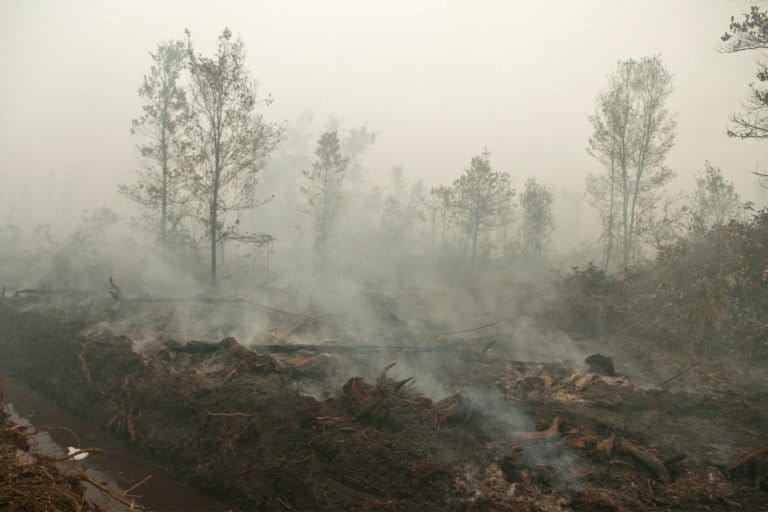
JAKARTA — In 2019, fires raged through Indonesia’s rainforests and peatlands, sparked by the deliberate burning of land for agriculture, and fanned by an El Niño system bringing drier-than-usual weather conditions. Ultimately, the Indonesian Ministry of Environment and Forestry would put the total affected area at 1.64 million hectares (4.05 million acres), an area half the size of Taiwan.
But the true extent of the burned area is nearly twice as large, according to an independent study by researchers in Europe and Canada. They found more than 3.11 million hectares (7.68 million acres) of areas had been burned in 2019, an area bigger than Belgium. It’s also far more extensive than the 2.6 million hectares (6.4 million acres) that the environment ministry says was burned in 2015, in what was the worst fire season in Indonesia this century.
Study co-author David Gaveau, from France-based satellite mapping initiative TheTreeMap, said his team had shared its analysis with the Indonesian environment ministry but hadn’t received any response. Mongabay also contacted the ministry for comment but didn’t receive a response.
Similar satellites, difference frequencies
The study derives its higher total for the burned area thanks to what the researchers say is a more accurate satellite-imaging platform — the European Space Agency’s Sentinel-2 satellite time-series analysis — than the one used by the ministry, the U.S. Geological Survey’s Landsat 8 OLI/TIRS Earth-observation satellite.
Both satellites measure infrared light, which can be used to detect charred vegetation. And both have medium-resolution imagery (10-30 meters, or 33-100 feet), which allow them to produce more detailed burned-area maps compared to coarse-resolution satellites (more than 250 m, or 820 ft), which generally omit small-scale fires.
But despite these similarities, the Landsat satellite takes photos of the same area once every 16 days. As a result, it may not detect some of the burns, especially when there’s obstruction in the form of cloud cover or smoke, Gaveau said.
The Sentinel-2 satellite, meanwhile, takes photos more frequently, every five days, increasing the chances of getting an obstruction-free photo of the ground.
The Sentinel-2 system is also comprised of two satellites, Sentinel-2a and 2b, and the overlap between them means the frequency at which some sites are photographed, known as the temporal resolution, shrinks to just two days, according to Gaveau.
All this makes it more likely that burning that’s not detected by Landsat due to cloud cover and smoke can still be observed by Sentinel-2.
This allows the latter to capture smaller areas — less than 100 hectares (247 acres) — and intermediate-size areas — 100 to 1,000 hectares (up to 2,470 acres) — of burns, usually in the form of small-scale agricultural fires and controlled burning.
“Indonesian skies can be very cloudy,” Gaveau told Mongabay. “With more frequent acquisitions such as Sentinel, we can detect more fires.”

Manual techniques vs. computer automation
In the case of the Indonesian environment ministry’s estimates, there’s also the possibility of omission as a result of the use of visual interpretation to flesh out the Landsat 8 Imagery. Visual interpretation is essentially a computer operator using a mouse to manually mark out the borders of a burned area. And while the method can yield accurate results for individual burned patches, it becomes much more intensive and time consuming at large spatial scales, when tens of thousands of small burn scars have to be marked out, according to Gaveau.
“Therefore, many small burn scars were missed by the official data set from the [environment] ministry,” he told Mongabay.
In analyzing the Sentinel imagery, by contrast, the researchers didn’t have to manually outline the burn perimeters, and instead employed the computational capabilities and automation of the Google Earth Engine. This allowed them to analyze more images and thus map more and smaller burn scars and associated details.
“In total we analyzed more than 47,000 images to detect fires, thanks to the computing power of the Google Earth Engine, which a traditional visual method could not obviously do,” Gaveau said.

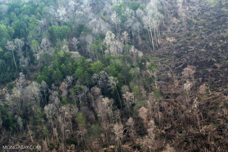
More forests and peatlands burned
The results reflect the differences. Gaveau and colleagues identified 137,000 hectares (338,500 acres) of forests impacted by the 2019 fires, nearly double the 70,000 hectares (173,000 acres) indicated in the ministry’s data set.
They also found 0.96 million hectares (2.37 million acres) of burned peatland, accounting for nearly a third of the total estimated burned area. This compared to the 0.64 million hectares (1.58 million acres) of burned peatland identified by the government.
Yet even with the higher accuracy, the new analysis is still likely to underestimate the true size of burned areas, with the researchers declaring a 24.4% omission error rate in their method. This means that there’s potentially 24.4% of burned areas that remained undetected.
This is because the researchers prioritized high user accuracy over absolute burned-area coverage, omitting burns that are hard to detect, such as low-intensity burns that occur beneath the forest canopy on mineral soils or on grasslands, which tend to regreen rapidly.
But this omission error is still smaller than the 50.5% omission error of the environment ministry’s estimate.
“Although we cannot extrapolate a corrected burned area across Indonesia, we are confident that more than 3.11 million hectares burned in 2019,” the researchers concluded in their paper.

Easily replicable analysis
Besides many small burns, the Landsat satellite also failed to capture more than 15,000 hectares (37,000 acres) of burned forests and peatlands around Berbak National Park in Jambi province on the island of Sumatra, the researchers wrote.
The park is home to immensely rich and diverse habitats that harbor hundreds of species, including the critically endangered Sumatran tiger (Panthera tigris sumatrae), Sumatran elephant (Elephas maximus sumatranus), painted terrapin (Batagur borneoensis), helmeted hornbill (Rhinoplax vigil), and the endangered Malayan tapir (Tapirus indicus).
The 2019 fires forced some tigers out of the forests, resulting in at least five recorded incidents of human-tiger conflict in nearby villages.

Gaveau said Landsat failed to detect these large burn scars around Berbak because they were obscured by clouds or by the thick smoke the fires produced, whereas the Sentinel satellites could better capture cloud- and smoke-free images of the ground.
Some of these losses were recorded only in 2020 by the Landsat-powered Global Forest Watch system that tracks changes in forest cover globally, Gaveau said.
He added the methods used in his study can be easily replicated to study other years, thanks to the code that the researchers published for generating pre- and post-fire composites for any year. Getting more accurate estimates of burned lands is central to addressing concerns about regional air quality and informing Indonesia’s policies on tackling climate change, Gaveau said.
This is especially important for fires on carbon-dense peatlands, a major source of Indonesia’s greenhouse gas emissions. The country is home to 36% of the world’s tropical peatlands, but its benchmark for reducing forest-related emissions, known as the FREL and submitted to the U.N. in 2016, failed to include emissions from peat fires as it lacked sufficient data.
The government is in the process of updating its FREL by adding emissions from peat fires and other wetlands.
Gaveau said the new analysis can help policymakers come up with a more accurate FREL.
“Combined with daily fire hotspots, our detailed burned-area map can also help identify ignition sites and estimate fire duration more precisely, and therefore contribute to forensic analyses of burning in concessions as well as assess policies and practices intended to reduce fires,” he said.
Challenging the official narrative
Yosi Amelia, a climate and forest program officer at environmental NGO Madani, welcomed the new methodology for estimating burned areas, but said a major hurdle is the reluctance of government officials to accept independent analyses.
“If the methodology [of civil society groups] is different [from that used by the government], the result will be different,” Yosi told Mongabay. “Sometimes it’s difficult for us to communicate with the government if we have our own data. We have to truly justify” why it’s beneficial to have different data sets and methodologies.
Gaveau, who has been researching Indonesia’s forests for nearly two decades, is no stranger to rubbing government officials the wrong way with data they consider unfavorable.
Last year, he came under scrutiny for publishing the preliminary results of his analysis of areas in seven provinces that were burned during the 2019 fires. (The new study builds on that analysis.)
In the early analysis, Gaveau found that 1.6 million hectares (4 million acres) of forest and degraded peatlands were burned between January and October in the seven provinces, compared to the environment ministry’s figure of less than 1.2 million hectares (3 million acres) in those same provinces.
The findings were published on the website of the Center for International Forestry Research (CIFOR), where Gaveau worked at the time as a research associate.
The environment ministry criticized the publication, saying that the results were flawed because they hadn’t been peer reviewed or verified by observations on the ground. CIFOR subsequently took down the analysis from its blog, and a month after that, Indonesian immigration authorities deported Gaveau.
The environment ministry claimed Gaveau’s deportation wasn’t related to the publication of the data, but because the French national didn’t have the proper permit to conduct research in Indonesia.
Gaveau said he believed he was deported because the Indonesian government didn’t like the fact that his research had identified a larger extent of burned areas than the official narrative.
“This [deportation] shouldn’t happen. The [environment] ministry should debate the pros and cons for each method [of estimating burned areas] instead,” he said. “It’s not a very progressive thing to do. It’s not a constructive thing to do [to deport me].”

Anti-science backlash
Some researchers have described Gaveau’s deportation a sign of growing tensions between the Indonesian government and the scientific community. Most recently, Greenpeace Indonesia received backlash from the government after it criticized President Joko Widodo’s speech during the COP26 climate talks in Glasgow, Scotland, where he touted the country’s success in bringing its deforestation rate to a two-decade low.
Citing the government’s own data, Greenpeace Indonesia pointed out that Indonesia’s deforestation rate had, in fact, increased from 2011 to 2019.
This prompted a supporter of the president — a polygamous failed politician who runs what’s widely seen as a troll farm amplifying online support for Widodo — to file a defamation lawsuit against Greenpeace Indonesia. But the petitioner quickly dropped the lawsuit, saying he didn’t want the government to be seen as “anti-critic.”
After that, Luhut Binsar Panjaitan, the chief investment minister and a close confidant and business partner to the president, demanded a financial audit of NGOs spreading “fake news” about Indonesia’s deforestation rate, in an apparent jab at Greenpeace Indonesia.
This isn’t the first time Luhut has issued such a threat. In 2018, he also threatened to audit Greenpeace Indonesia after some of its activists joined their colleagues from other Greenpeace branches in boarding a tanker transporting palm oil off the coast of Spain. The move was in a protest against deforestation caused by the expansion of the palm oil industry in Indonesia.
Luhut said at the time that an audit was warranted because Greenpeace had harmed the country’s palm oil industry through its actions, and declared that the organization’s Indonesian members should “respect their own country.”
Gaveau said he hoped the government, especially the environment ministry, would be more open to working with scientists in mapping deforestation and burned areas, rather than seeing them as an enemy.
“Mapping technique is such a fast evolving field,” he said. “By engaging in debate, the [environment] ministry will be able to improve its mapping technique.”
Banner image: A burned area in southern Mappi, Papua province, Indonesia. Image courtesy of Ulet Ifansasti/Greenpeace.
FEEDBACK: Use this form to send a message to the author of this post. If you want to post a public comment, you can do that at the bottom of the page.