Cloudscapes over Sumatra
Nov 7, 2021
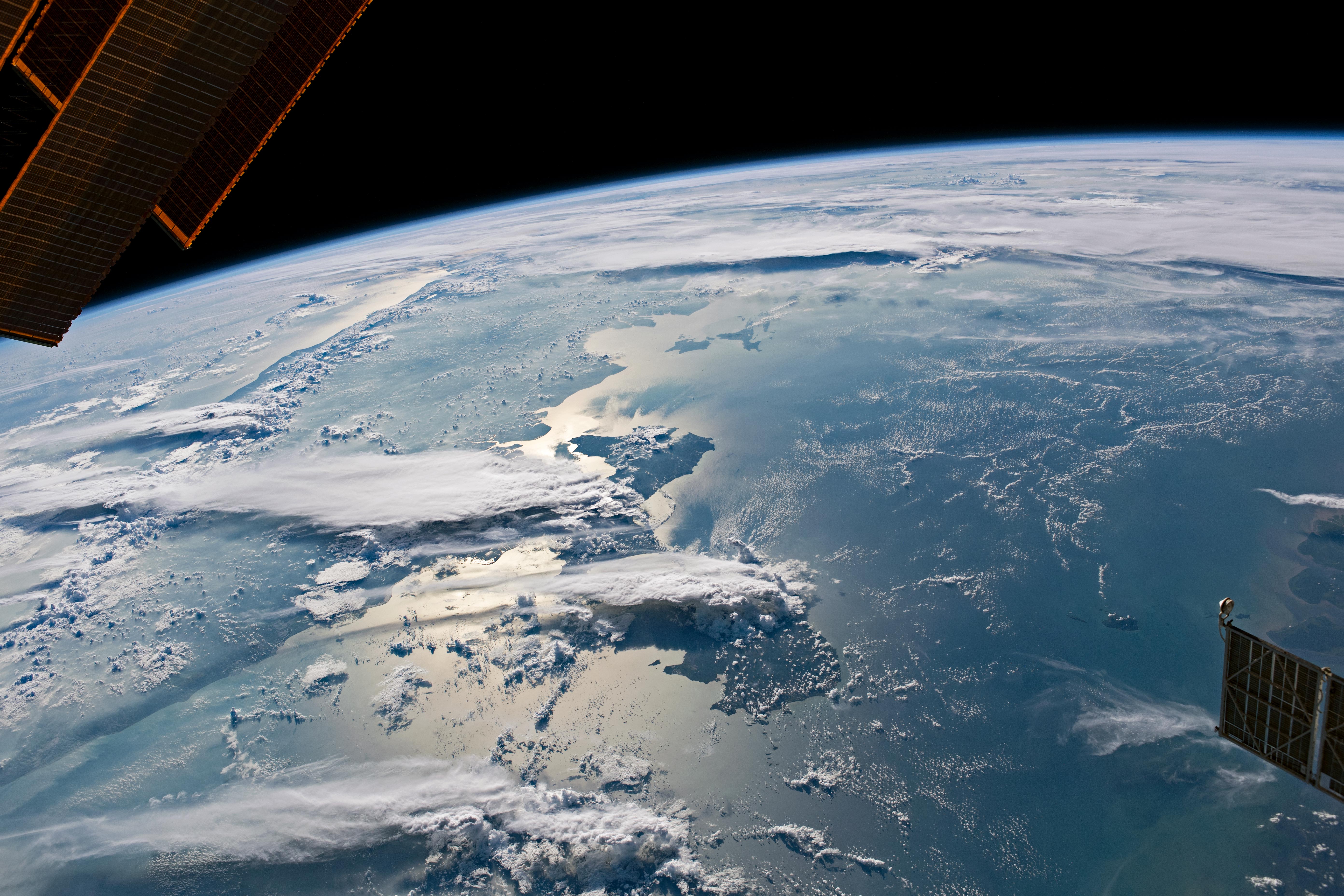
An astronaut onboard the International Space Station shot this panoramic, west-looking photograph of cloudscapes around Sumatra, one of Indonesia’s largest islands. The image also shows the smaller, neighboring Bangka and Belitung Islands, the Java Sea, and the west coast of Borneo (far right margin, above the solar panel). The long, bright clouds—generated by thunderstorms—cast dark shadows on the land and sea below. The brightest zone of the Sun’s reflection on the water (sunglint) highlights the narrow strait between Sumatra and the islands. Singapore is hidden beneath a thunderstorm.
On the day this photo was taken, winds were blowing from the northeast (right to left in this view). After crossing the Java Sea, the moist air would have risen as it was heated. Such heating likely caused thunderstorms to form over each island.
The tops of some of the storms were sheared off by winds to form clouds with flattened upper surfaces; these as called anvil clouds. Winds can extend anvils across great distances, making long, narrow tails. The big anvil that starts over Bangka Island stretches about 200 kilometers (120 miles) across Sumatra into the Indian Ocean. Other anvil clouds formed where air was forced to rise over the high Barisan Mountains on Sumatra’s southwest coast (far left). Small cumulus clouds also formed over the small line of Mentawai Islands (top left).
Cloud-free zones appear over the Java Sea and the Indian Ocean. Both zones lie downwind of landmasses (Borneo and Sumatra), with air apparently descending onto the sea surface on this day. Descending air usually suppresses cloud formation.
Astronaut photograph ISS065-E-168303 was acquired on July 18, 2021, with a Nikon D5 digital camera using a focal length of 35 millimeters. It is provided by the ISS Crew Earth Observations Facility and the Earth Science and Remote Sensing Unit, Johnson Space Center. The image was taken by a member of the Expedition 65 crew. The image has been cropped and enhanced to improve contrast, and lens artifacts have been removed. The International Space Station Program supports the laboratory as part of the ISS National Lab to help astronauts take pictures of Earth that will be of the greatest value to scientists and the public, and to make those images freely available on the Internet. Additional images taken by astronauts and cosmonauts can be viewed at the NASA/JSC Gateway to Astronaut Photography of Earth. Caption by Justin Wilkinson, Texas State University, JETS Contract at NASA-JSC.