Menindee Lakes Finally Refilling
May 20, 2021


For the first time in five years, Australia’s Menindee Lakes are brimming with water. The lakes are a series of nine large, shallow depressions that hold water supplies for the nearby towns of Menindee and Broken Hill, located about 110 kilometers (70 miles) away. The water is also used for irrigation and domestic purposes on the lower Darling River.
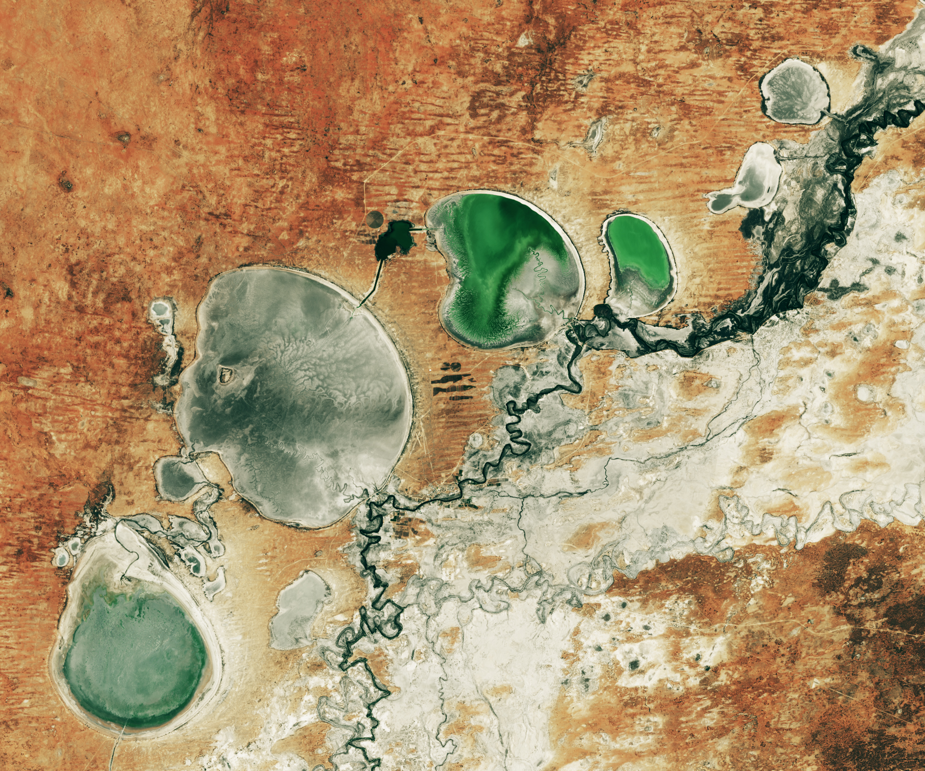
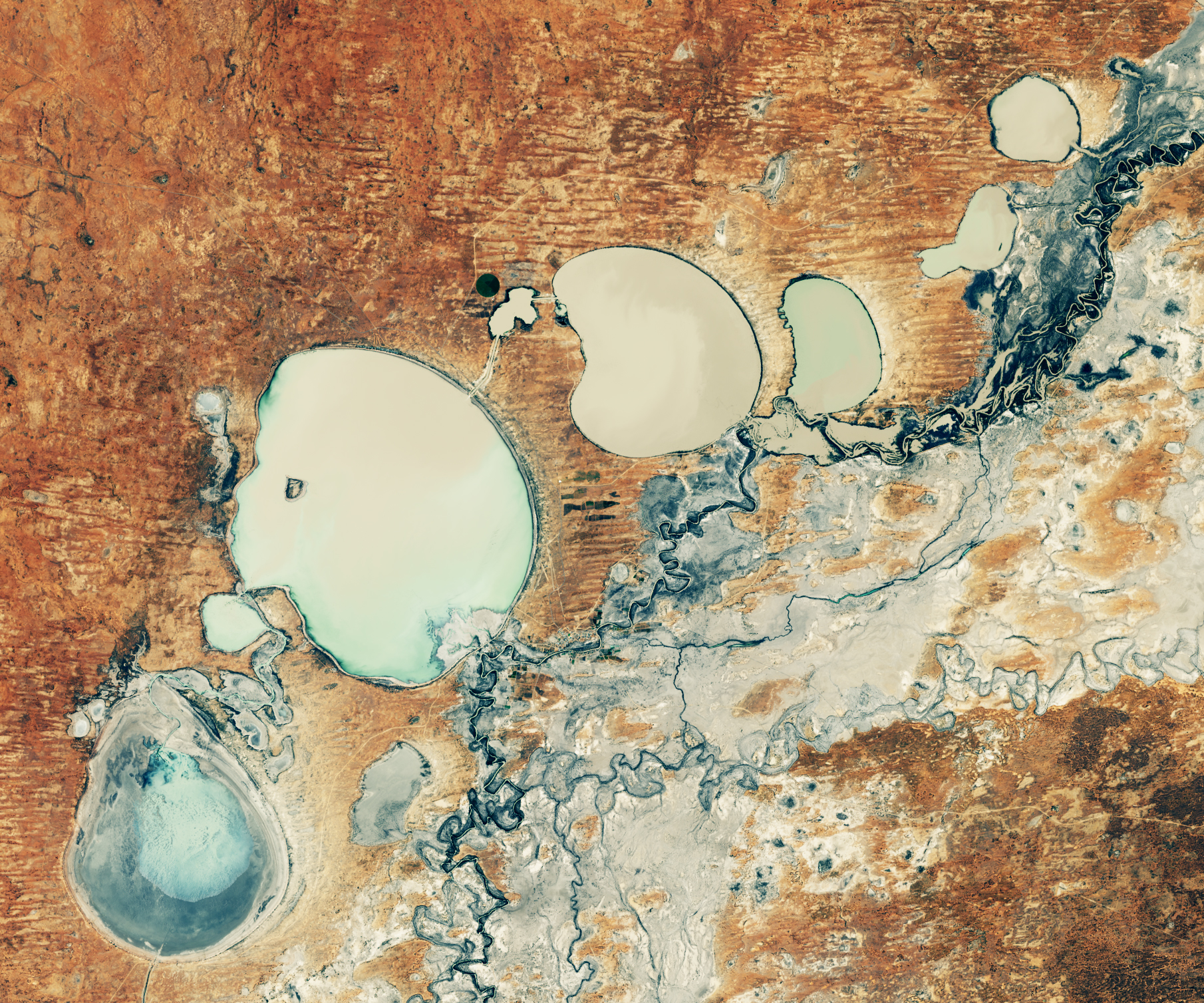
The images above show the series of Menindee Lakes during summer on February 2, 2019 (right), and during the fall on May 14, 2021 (left), as observed by the Operational Land Imager (OLI) on Landsat 8. The green color in the lakes in the summer is likely algae or vegetation, while the milky grey color this May is likely due to suspended sediment stirred up by the refilling of the basin.
Water managers opened up floodgates between Lake Pamamaroo and Menindee in April 2021 for the first time since 2016. Lake Cawndilla is filling with water for the first time since 2017. According to WaterNSW, the Menindee Lakes were at 49.9 percent capacity as of May 19, 2021.
The lakes follow a boom-and-bust pattern, filling sporadically when there are heavy rains upstream and then drying due to the often arid climate. But a prolonged drought has left them practically desiccated since 2016. The drought was particularly noteworthy in 2018-19, when the lack of water contributed to the death of a million fish in the lakes.
In the summer of 2020-21 (December through February), parts of New South Wales experienced the heaviest rainfall and worst flooding in six decades. Hundreds of thousands of people were displaced and several rivers reached major flood levels.
Those floodwaters slowly made their way through the Darling-Baaka River system in northern New South Wales to reach the Menindee Lakes. By early June, water managers expect the two upper lakes to be at capacity. The water inflows are expected to bring more farming, fishing, and tourism to the region in upcoming months.
NASA Earth Observatory images by Lauren Dauphin, using Landsat data from the U.S. Geological Survey. Story by Kasha Patel.