Ice Jam in Buckland
May 26, 2021
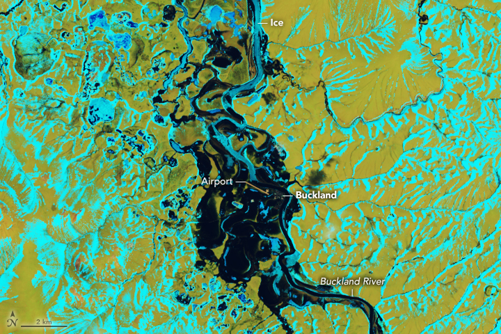
On May 12, 2021, chunks of ice blocked the flow of the Buckland River in northwest Alaska, causing widespread flooding across the city and the native village of Buckland. The community of around 500 residents was inundated in what the vice mayor called the worst flooding in 20 years.
Ice jams commonly occur in Arctic regions during the springtime when snow and ice melt quickly. As the ice breaks up, chunks flow downstream into narrower courses and can clog a river, spilling water over the banks and onto surrounding lands.
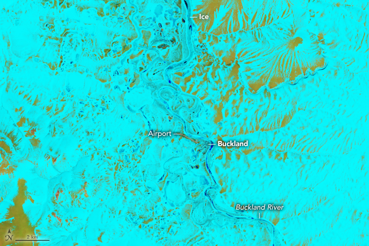
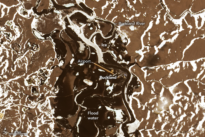
The false-color images above show the region around Buckland on April 27 and May 13, 2021, before and during the flooding. These images were acquired by the Operational Land Imager (OLI) on Landsat 8, using bands 6-5-4. In these false-color images, visible and infrared wavelengths were combined to better differentiate areas of water that are frozen (light blue) from those that contain significant meltwater (dark blue); bare ground is green. The image below shows the same area in natural color, where floodwater is dark brown.
Water began rising out of the Buckland River’s banks on the night of May 12. By noon on May 13, the river crested at least 12 feet (4.6 meters) above normal. Parts of Buckland experienced more than five feet (1.5 meters) of flooding, which cut off road access to the airport and damaged a few houses and sewer systems. It also affected a water treatment plant, causing residents to boil water for several days. On May 17, the ice jam cleared up and water levels dropped, though the governor declared a disaster to activate recovery programs.
NASA Earth Observatory images by Lauren Dauphin, using Landsat data from the U.S. Geological Survey. Story by Kasha Patel.


